The 395

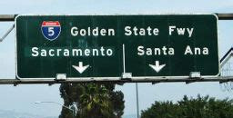
I want to drive up The 395 in California. For those of you in the East, it would be Route 395, but in the West, it's THE 395. We always include the article. Because originally freeways had names, not numbers. The San Diego Freeway became The 405, and The Golden State Freeway became The 5. We are loathe to give up the THE. But I digress.

The 395 goes up the eastern side of the Sierra Nevada Mountains, going through the dusty little towns of Tom’s Place (pop 254) and Lone Pine (pop 2000 – quite the metropolis). It’s where the Sierras loom large, the weather is a little harsh, and the
scenery is beautiful. It’s a little desolate, but oh it fills my soul.


The 395 is the road you take from L.A. to get to Mammoth (and Bishop) to go skiing. In my 20’s I was an occasional skier, but not even enough to own my own skis. But there were several times I’ve been up that route, and I LOVE it. It is wild and windswept, and bitter cold in the winter. But the mountains are rugged and majestic. There is high desert scrub, occasional trees, and wide-open places. No snow on the ground when I’ve been there, but certainly on the mountains.

The last time I was anywhere near there was over 30 years ago. We never get over there because Yosemite, the Sequoias and Kings Canyon are all on the west side of the Sierras, as is 99% of the population and development in California. And it’s a long drive because you have to go around the Sierras either to the north or the south, except for one pass that is closed from about October through June.

The eastern side of the Sierras is also known as the Owens Valley. In the early 20th century, Owens Valley was some of the highest producing farmland in both California and the entire nation. California has fabulous soil; in most of the country the topsoil, the good stuff that actually grows crops, goes down one or two inches. In California, it goes down at least three-to-four inches, often six, and sometimes even as much as ten or twelve. And the quality of the soil is fabulous. Crop yields in California can be two or three times those in other parts of the country, sometimes even four – and that’s using the exact same farming techniques.
The problem with California is the lack of water. In the first part of the 20th century, Los Angeles, starting to sprawl and needing water, quietly bought up land and water rights throughout the Owens Valley. Before anyone realized it, the valley had almost none of their water rights left. Everything was strategically bought up and diverted to L.A. Now no crops grow there, on some of the most fertile farmland in the world, because L.A. owns the water rights. It’s dry and can barely support the sparse population. There was lawsuit upon lawsuit, and there is no way to get those water rights back. For anyone who loves the land up there, it’s terrible. And it’s allowed L.A. to sprawl and be a water-thirsty monster. Properties of Thirst, by Marianne Wiggins, is a fictional tale about this area that is absolutely wonderful, and made me fall in love with the valley all over again. It’s a wonderful book if you long for the West.


Along the 395 you also pass Manzanar, the WWII Japanese Internment Camp. You drive along this long and desolate two-lane road, going 70 or 80 miles an hour; you come upon it, very unassuming. At one point over 10,000 Japanese were interred there, and their story of resilience in the midst of internment so awful is amazing. When I first got out of the car, my first through was that it is so breathtakingly beautiful. And so frigidly cold. How ever did they manage? When I was there, there was only a small cemetery with a lonely short obelisk monument, and a single roadside placard. Some of the concrete slabs remained, and maybe an old guardhouse. So very little to honor so much. So desolate.
Ansel Adams was hired by the US Government to take pictures and document the camps during the internment. However, the caveat was that he couldn’t include anything in the pictures that indicated that there were fences or guards or anything unseemly; it had to be sanitized. So he did as he was told, but he also discreetly took photos that showed indicators of what was really going on. It’s hard to find copies of the books now, but I loved reading them and looking at, inspecting actually, the photos.

I would love to stop at Manzanar again. I Googled it, and now they even have a parking lot. They've made it a real historic monument. It’s more of a place to stop now, as it should be.

Further up, you pass by Mammoth and the turnoff to the whole ski area, and then further north is Mono Lake and the Tufa Towers. Historically, Mono Lake was a lovely lake with rich diversity of wildlife: birds and water-life (brine shrimp), but it's also heavily alkalai, as it is a terminal lake. Underwater calcium carbonate precipitated into limestone which formed into tower-like structures. Well, when all the water rights were bought up by L.A., Mono Lake was a victim and its water level and surface area reduced dramatically. It was a huge ecological loss that has never recovered and is still a shrunken size; however, it revealed the Tufa Towers. Tufa Towers are weird, white, bumpy and drippy-looking, but also razor-sharpish uneven towers, which make you feel like you’re on another planet. When I was last there while in college, I really didn’t appreciate it. I would like to go back and just sit and absorb it.

But the final joy would be to go over Tioga Pass. The Sierras run 400 miles north-to-south, and range from 50 to 80 miles across east-to-west. The highest peak is Mt. Whitney at 14,505 feet, and my dad climbed it as a young man. You can only cross the Sierras at Tioga Pass and Crater Lake; otherwise you have to go all the way around. Tioga Pass goes from the area of Mono Lake on the east side, up and over the mountains, and into Yosemite Valley on the west side. It’s up pasts the tree line, and there is lots and lots of granite.

The road typically closes in October or November due to snow, and opens again between May and June after it’s plowed; in 2019 with heavy snows it didn’t open until July 1. This picture shows the 2019 snow pack in April, when they were already working on plowing. Plowing takes up to a couple of months.


Anyway, I’ve never driven over Tioga Pass and I very much want to. I think my dad did at one point, and I know my grandpa did, sometime before WWII. Back in those days, it was a one-lane road rather than two-lane, and of course unpaved. They would open the road one way, and give the last car in the line a red flag which they would carry over to the other side, to show that it was clear to let cars through in the opposite direction. Well, Grandpa’s family had a very.old.car. Probably not a Model T, but certainly of that era.
They started out toward the front of the line of cars. But they were very slow compared to all the “modern” cars, so at every wide spot in the road, other cars would pass them and eventually they were the last car in line, carrying the flag.
Well, all the cars got to the other side in a predictable amount of time, and they confirmed that the last car with the flag was still to come. Apparently, they were so slow that they arrived two hours after everyone else. The road officials were worried and getting ready to send out a search party when they finally came chugging down the last stretch. I have no desire to hold up traffic, but I do aspire to do things that I have no business doing with the meager resources at hand. I’d like to do things like Grandpa.
And I would love to go up and over the pass, in a car that had some power to it. It’s quite a climb (9945’), but the views must be amazing. I hope there are places where you can get peeks of Yosemite Valley from above, as Yosemite is one of my favorite places on earth.


So this is where I want to roam – up the wonderful and desolate 395, and over Tioga Pass. Theoretically I could do it all in one very long day, but I’m dead set on taking my time. There must be some small but suitable, or even unsuitable, hotels along the way. I’m sure the dusty towns (really outposts back in the 80’s) are bigger now, and not nearly as charming, but the land doesn’t change. I just want to go and almost-silently absorb it all. The solitude would be wonderful. The wind whistles and howls. I envision going in the winter, except for Tioga, but I’d also love so see the high desert in summer. So I guess I really need two trips to feel like I’ve experienced and known it.
I confess that it’s too lonely and dusty for me to live out there, but I feel like that’s where I belong. I actually have a poster of the Easter Sierras in my garage, directly in front of my car and over the steps into the house; I can look at it and rest my soul before heading inside. So I’ll make a trip of it, take lots of pictures and if I get a really good one, will hang it in my garage. I’ll print a photo book, so late at night when I’m trying to shed the things of the day, I can look through it, breathe deeply, and be at peace.



Comments